Dune weather summary: Aden Hills Off-Highway Vehicle Area, 54°, 3 mph. Alkali Lake OHV Area, 64°, 8 mph. Amargosa Big Dune, 57°, 5 mph. Aurora Open OHV Area, 39°, 3 mph. Bangs Canyon OHV Trails, 45°, 3 mph. Barnwell Mountain Recreational Area, 57°, 0 mph. Blue Creek OHV Area, 61°, 14 mph. Boulders OHV Staging Area, 63°, 0 mph. Buttercup Valley, 70°, 9 mph. Cameo Cliffs/Hook and OHV Ladder Trail System, 54°, 6 mph. Chappie/Shasta Off-Highway Vehicle Recreation Area, 55°, 0 mph. Cinder Hills OHV Area, 42°, 20 mph. Copper Basin Dunes OHV Area, 64°, 6 mph. Coral Pink Sand Dunes, 54°, 5 mph. Crescent Sand Dunes, 37°, 5 mph. Cross Bar Ranch Off-Road Park, 58°, 0 mph. Crossroads OHV Area, 73°, 6 mph. Dove Springs OHV Area, 53°, 0 mph. Dumont Dunes, 64°, 2 mph. Dunes Off-Highway Vehicle Area, 37°, 5 mph. El Mirage OHV Area, 40°, 3 mph. Escondido Draw Recreational Area, 64°, 17 mph. Fort Sage Off-Highway Vehicle Area, 46°, 1 mph, active alert: Lake Wind Advisory. Fossil Creek OHV Trail, 45°, 3 mph. Gemini Bridges, 45°, 0 mph. Glamis / Imperial Sand Dunes, 64°, 8 mph. Glenwood Open OHV Area, 39°, 3 mph. Gordon's Well, 70°, 9 mph. Grand Valley Open OHV Area, 46°, 0 mph. Greater Sand Dunes SRMA, 36°, 6 mph, active alert: High Wind Watch. Hackberry Lake Off-Highway Vehicle Use Area, 64°, 8 mph. Hayfield Draw OHV Area, 63°, 0 mph. Haystack Mountain Off-Highway Vehicle Area, 53°, 7 mph, active alert: Flood Watch. Head Canyon OHV Recreation Area, 37°, 5 mph. Hog Canyon OHV Trail System, 55°, 9 mph. Hot Well Dunes Recreation Area, 72°, 5 mph. Hungry Valley SVRA, 44°, 4 mph. Jawbone Canyon OHV Area, 53°, 0 mph. Johnson Valley OHV Area, 59°, 7 mph. Killpecker Sand Dunes Open Play Area, 36°, 6 mph, active alert: High Wind Watch. Knolls Off-Highway Vehicle Special Recreation Management Area (SRMA), 43°, 3 mph. Little Sahara Recreation Area, 45°, 0 mph. Little Sahara State Park, 61°, 8 mph. McCullough Peaks OHV Area, 48°, 0 mph. Mescalero Sands North Dune Off-Highway Vehicle Area, 63°, 11 mph, active alert: Flood Watch. Millican Valley OHV Trail System, 45°, 6 mph. Moon Rocks OHV Area, 47°, 1 mph, active alert: Lake Wind Advisory. Nellis Dunes OHV Area, 59°, 5 mph. North Sand Hills OHV Area, 37°, 8 mph. Northwest OHV Park, 64°, 0 mph. Oceano Dunes / Pismo Beach, 55°, 0 mph, active alert: Coastal Flood Advisory. Ocotillo Wells SVRA, 72°, 12 mph. Pipestone OHV Area, 36°, 1 mph, active alert: Dense Fog Advisory. Poison Spider / Gold Bar, 45°, 0 mph. Rabbit Creek OHV Trail, 52°, 9 mph. Radar Hill OHV Area, 36°, 0 mph. Rasor Off-Highway Vehicle Area, 57°, 7 mph. Red Sands Off-Highway Vehicle Area, 63°, 5 mph. Rice Canyon Off-Highway Vehicle Area, 46°, 2 mph, active alert: Lake Wind Advisory. Robledo Mountains OHV Trail System, 63°, 5 mph. Rosita Flats OHV Area, 61°, 14 mph. Samoa Dunes, 55°, 9 mph, active alert: Coastal Flood Advisory. Sand Flats Recreation Area, 45°, 0 mph. Sand Mountain Open Off-Highway Vehicle Area, 39°, 0 mph. Sand Mountain Pipeline Designated Dispersed Camping Area, 54°, 5 mph. Sand Mountain Recreation Area, 50°, 4 mph, active alert: Lake Wind Advisory. Seep Springs OHV Area, 46°, 3 mph. Shoshone OHV Trail System, 39°, 0 mph. Shotgun Creek OHV Staging Area, 39°, 0 mph. Silver Lake ORV Area, 55°, 3 mph. South Cow Mountain OHV Management Area, 46°, 0 mph, active alert: Frost Advisory. St. Anthony Sand Dunes, 36°, 3 mph. St. Helen Motorsport Area, 48°, 6 mph. Standard Wash OHV Area, 64°, 6 mph. Stoddard Valley OHV Area, 53°, 5 mph. Table Mesa Recreation Area, 63°, 0 mph. Virtue Flat Off-Highway Vehicle Area, 45°, 6 mph. Weiser Dunes, 45°, 3 mph. Whitewash Sand Dunes Open OHV Area and Trail System, 45°, 0 mph. Winnemucca Sand Dunes, 37°, 7 mph.

ⓘ
Aden Hills Off-Highway… 54° 3 mph Alkali Lake OHV Area 64° 8 mph Amargosa Big Dune 57° 5 mph Aurora Open OHV Area 39° 3 mph Bangs Canyon OHV Trails 45° 3 mph Barnwell Mountain… 57° 0 mph Blue Creek OHV Area 61° 14 mph Boulders OHV Staging Area 63° 0 mph Buttercup Valley 70° 9 mph Cameo Cliffs/Hook and OHV… 54° 6 mph Chappie/Shasta Off-Highway… 55° 0 mph Cinder Hills OHV Area 42° 20 mph Copper Basin Dunes OHV Area 64° 6 mph Coral Pink Sand Dunes 54° 5 mph Crescent Sand Dunes 37° 5 mph Cross Bar Ranch Off-Road Park 58° 0 mph Crossroads OHV Area 73° 6 mph Dove Springs OHV Area 53° 0 mph Dumont Dunes 64° 2 mph Dunes Off-Highway Vehicle Area 37° 5 mph El Mirage OHV Area 40° 3 mph Escondido Draw Recreational… 64° 17 mph Fort Sage Off-Highway… 46° 1 mph Fossil Creek OHV Trail 45° 3 mph Gemini Bridges 45° 0 mph Glamis / Imperial Sand Dunes 64° 8 mph Glenwood Open OHV Area 39° 3 mph Gordon's Well 70° 9 mph Grand Valley Open OHV Area 46° 0 mph Greater Sand Dunes SRMA 36° 6 mph Hackberry Lake Off-Highway… 64° 8 mph Hayfield Draw OHV Area 63° 0 mph Haystack Mountain… 53° 7 mph Head Canyon OHV Recreation… 37° 5 mph Hog Canyon OHV Trail System 55° 9 mph Hot Well Dunes Recreation Area 72° 5 mph Hungry Valley SVRA 44° 4 mph Jawbone Canyon OHV Area 53° 0 mph Johnson Valley OHV Area 59° 7 mph Killpecker Sand Dunes Open… 36° 6 mph Knolls Off-Highway Vehicle… 43° 3 mph Little Sahara Recreation Area 45° 0 mph Little Sahara State Park 61° 8 mph McCullough Peaks OHV Area 48° 0 mph Mescalero Sands North Dune… 63° 11 mph Millican Valley OHV Trail… 45° 6 mph Moon Rocks OHV Area 47° 1 mph Nellis Dunes OHV Area 59° 5 mph North Sand Hills OHV Area 37° 8 mph Northwest OHV Park 64° 0 mph Oceano Dunes / Pismo Beach 55° 0 mph Ocotillo Wells SVRA 72° 12 mph Pipestone OHV Area 36° 1 mph Poison Spider / Gold Bar 45° 0 mph Rabbit Creek OHV Trail 52° 9 mph Radar Hill OHV Area 36° 0 mph Rasor Off-Highway Vehicle Area 57° 7 mph Red Sands Off-Highway… 63° 5 mph Rice Canyon Off-Highway… 46° 2 mph Robledo Mountains OHV Trail… 63° 5 mph Rosita Flats OHV Area 61° 14 mph Samoa Dunes 55° 9 mph Sand Flats Recreation Area 45° 0 mph Sand Mountain Open… 39° 0 mph Sand Mountain Pipeline… 54° 5 mph Sand Mountain Recreation Area 50° 4 mph Seep Springs OHV Area 46° 3 mph Shoshone OHV Trail System 39° 0 mph Shotgun Creek OHV Staging Area 39° 0 mph Silver Lake ORV Area 55° 3 mph South Cow Mountain OHV… 46° 0 mph St. Anthony Sand Dunes 36° 3 mph St. Helen Motorsport Area 48° 6 mph Standard Wash OHV Area 64° 6 mph Stoddard Valley OHV Area 53° 5 mph Table Mesa Recreation Area 63° 0 mph Virtue Flat Off-Highway… 45° 6 mph Weiser Dunes 45° 3 mph Whitewash Sand Dunes Open… 45° 0 mph Winnemucca Sand Dunes 37° 7 mph

Halloween

Happy Halloween from Full Throttle Trader

Rasor Off-Highway Vehicle Area

Remote Riding Near Baker

LocationBetween Interstate 15 and the Mojave National Preserve, about 25 miles southwest of Baker, CA (San Bernardino County)
Entry points2 verified
SizeElevation runs from about 2,427 feet down to 1,275 feet at the Mojave River
Conditions57° · 7 mph

Trip check

Before you go

  • Permit status not confirmed. Check with the managing agency.
  • This is a remote area with no services — carry water, fuel and recovery gear. The Mojave Road passes through and is open to street-legal vehicles only.

Guide

About this area

Rasor is the remote end of Mojave riding — rolling hills, open valleys and sand dunes between Interstate 15 and the Mojave National Preserve, about 25 miles southwest of Baker. Elevation drops from roughly 2,427 feet down to 1,275 feet at the Mojave River, through creosote scrub and seasonal wildflowers.

Camping

Camping is permitted anywhere within the open area, up to 14 consecutive days. Afton Canyon Campground is $6 per night on a first-come basis with a 14-day limit — shade structure, parking, table, fire pit and grill, with vault toilets centrally located.

Facilities

Afton Canyon Campground has vault toilets, tables, fire pits and grills. There are no services in the open riding area itself.

Full agency description

Overview Rasor Off-Highway Vehicle Recreation Area is an exciting and more remote area for the off-highway vehicle user. The area has rolling hills, open valleys, and sand dunes that invite the rider willing to travel to this area. Elevations range from about 2,427 feet elevation down to about 1,275 feet elevation at the Mojave River. Besides the remote nature of the area, another attraction is the historic Mojave Road which runs through the riding area into the Mojave National Preserve (street-legal vehicles only in the Preserve). Vegetation consists of creosote scrub, some annual grasses and wild flowers. Download a brochure and map for the Rasor Off-Highway Vehicle Recreation Area. Off-Highway Vehicle Use Visitors to Rasor enjoy excellent recreation opportunities including open desert riding on All-Terrain Vehicles (ATVs), motorcycles, dune buggies, Utility Terrain Vehicles (UTVs), and camping. In addition to the riding and camping activities, this area provides access and support facilities for staging OHV and 4X4 vehicle touring into the adjacent area of the Mojave Trails National Monument (MTNM). This and other surrounding limited use areas require vehicles to travel on designated routes. There is also street legal vehicle access into the Mojave National Preserve along the Mojave Road. Access roads to Rasor are Basin and Rasor Roads via Interstate 15, 12 miles southwest of Baker, CA. The following partial list of regulations and tips should help OHV users and other recreationists appreciate and enjoy the use of these public lands. Please visit the State of California OHV page for more information about California’s regulations and requirements. OHVs owned by California residents must be registered with the California DMV and must display a valid “Green Sticker” or “Red Sticker”. If you are NOT a resident of California and your OHV is not registered in your home state, you are required to have a NON-RESIDENT Green Sticker OHV permit. On the ground, motorized vehicles should yield to non-motorized craft and aircraft. OHVs must be equipped with an approved muffler, brakes, and spark arrester. It is illegal for anyone who is under the influence of alcohol or drugs to operate an OHV. It is illegal to bring, dispose of, or possess any glass container, empty or not, within the open area. It is illegal to bring, dispose of, or possess any firewood containing nails, screws or other metal hardware within the open area. NO PALLETS! It is illegal to possess and/or discharge fireworks. Persons on an ATV under 14 years of age must be supervised by a parent or guardian. All persons, regardless of age, who operate an ATV on Public Lands must wear an approved safety helmet; Carrying passengers is prohibited on ATVs; Remember—Safety First, Every Ride, Every Time! Hunting & Shooting The Rasor OHV Recreation Area, as well as surrounding Limited Use Areas, are open to recreational shooting with the exception of the Afton Canyon Area of Critical Environmental Concern (ACEC). The Afton Canyon ACEC is closed to recreational shooting except legal shotgun hunting outside a ½-mile perimeter of the campground and middle of railroad trestle. Seasons and bag limits vary so be sure to check with the California Department of Fish and Wildlife for complete and current hunting regulations. Fire and county ordinance restrictions may apply as well. In the immediate vicinity of wildlife guzzlers, hunting is limited to 30 minutes. It is illegal to shoot within 150 yards of any campsite or to shoot at trees, signs, glass bottles, domestic livestock, outbuildings, or other objects on federal land. On private land, visitors must obtain permission from the landowner to discharge fire arms. Camping Camping is permitted anywhere within the open area of Rasor, but is limited to a maximum of 14 consecutive days. There is less primitive camping available at the Afton Canyon campground, situated at the west end of the canyon. This newly renovated campground provides several sites, available on a first-come basis for a fee of $6 per night. There is also a 14-day stay limit. Each site is equipped with a shade structure, parking area, table, fire pit, and grill. Vault toilets are centrally located. Campfire permits are required and may be restricted in fire season (typically May-October). Fire danger is extreme during most of the year. Campfire permits can be obtained online at www.preventwildfireca.org.
At a glance

Quick facts

Best season
Fall through spring — summer heat is severe
Camping limit
Camping limited to a maximum of 14 consecutive days
Managing agency
BLM Barstow Field Office

Access

Getting there

  • Rasor Road east of I-15 — graded dirtEntrance

    The riding area sits between Interstate 15 and the Mojave National Preserve, about 25 miles southwest of Baker. Take Rasor Road east off I-15 — it is a GRADED DIRT ROAD.

    Pin from the managing agency
  • Basin Road east of I-15 — graded dirtEntrance

    Basin Road, also east of I-15, is the second access road. Like Rasor Road it is graded dirt — fine in the dry, not somewhere to be caught after rain.

    Pin from the managing agency

Rules

Rules

Standard OHV rules (11)

Common equipment, registration and trail-use rules still apply.

  • ⭐ RIDE TO THE HIGHEST SAFETY STANDARD, NOT THE LEGAL MINIMUM. What is written below is what the managing agency requires. A helmet, eye protection, a flag and proper gear are what get you home — wear them whether or not the law where you are riding insists on it.
  • OHVs must have an approved muffler, brakes and spark arrester. Every ATV operator, regardless of age, must wear an approved safety helmet, and ATVs may not carry passengers. Glass containers are prohibited. Firewood containing nails or metal hardware is prohibited — no pallets. Fireworks are prohibited. Recreational shooting is allowed except in the Afton Canyon ACEC, and never within 150 yards of a campsite.
  • 🪖 Side-by-side / UTV (factory-built, steering wheel, bucket seats, under 1,000cc, does over 30 mph): helmets on the driver and every passenger, and seat belts or a harness fastened whenever it is moving. That is California law on public land.
  • 🪖 Sand car, sand rail, dune buggy, Jeep, or anything home-built or over 1,000cc: no helmet or seat-belt law applies. Wear them anyway — State Parks recommend it, and so do we.
  • 🪖 Quads and ATVs: helmet on every rider, any age. Dirt bikes: helmet required under 18.
  • ⚠️ Tuned it past 30 mph? A machine built for 30 or under that now goes faster is treated like a side-by-side — helmet and belt rules apply.
  • 👶 A child seat does not replace a helmet. In a side-by-side, a child in a car seat still wears one.
  • Source: California Vehicle Code §500, §38505, §38601–38602 — checked Aug 2026.
  • 🪖 Any helmet the law requires must meet FMVSS 218 and carry a DOT label — CVC 27802.
  • 📖 CHECK THE LAW YOURSELF — these requirements come from California State Parks OHMVR — Laws & Safety. Rules change, and you are responsible for compliance: ohv.parks.ca.gov
  • 🗺️ NO SIGNAL? TAKE AN OFFLINE MAP. BLM publish free GEOREFERENCED PDF maps that show your live GPS position with no cell service, in the Avenza Maps app or similar. Download the map for this area BEFORE you leave tarmac: www.blm.gov

Permits

Permits & registration

Permit and registration details

• If you are NOT a resident of California and your OHV is not registered in your home state, you are required to have a NON-RESIDENT Green Sticker OHV permit. • This newly renovated campground provides several sites, available on a first-come basis for a fee of $6 per night. • Campfire permits are required and may be restricted in fire season (typically May-October). • Campfire permits can be obtained online at www.preventwildfireca.org. No day-use fee for the open area. Afton Canyon Campground is $6 per night. California OHV registration — Green Sticker or Red Sticker — is required, and non-residents need a Non-Resident OHV permit. A campfire permit is required and can be obtained at preventwildfireca.org.
State residents
California residents: OHV must display a current Green Sticker or Red Sticker registration from the CA DMV.
Out-of-state riders
Out-of-state riders: a California Nonresident OHV Use Permit is required unless your OHV carries current registration from your home state. $30 ($31.95 online), valid from purchase through December 31 of that year.
BLM Barstow Field Office official page (current closures & alerts)

Permit and registration rules change. Confirm current requirements with the managing agency before you ride — you are responsible for compliance.

Trip support

Fuel, food & local help

Local fuel notes (4)
  • Nearest towns with services, per the managing agency:
  • Baker — about 12 miles
  • ��️ Fill your tanks and cans before you turn off the highway.
  • Backcountry stations keep short hours and some close seasonally.

Pump gas & diesel

  • Baker, CA — the last stop on I-15fuel

    ABOUT 25 MILES NORTHEAST · Baker is the obvious fuel stop on this stretch of I-15. There is absolutely nothing on Rasor or Basin Road.

Marketplace

Rigs and vehicles

For sale nearby

Show more
$21,000

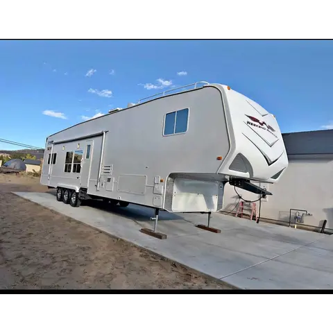
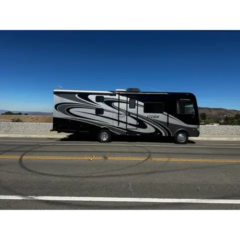
2008 Weekend Warrior cl4005

2008Henderson, NV98 miles away
StandardUsed
SaleToy Hauler

2008 Weekend Warrior cl4005 Fully Renovated Toy Hauler. New tires, new vinyl flooring, updated LED lighting, new bulldog landing gear, fresh...

Toy Hauler1 week ago

Elsewhere

These listings are not nearby and their sellers have not said they ride here.

$9,000

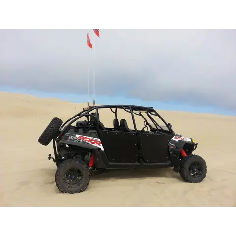
2013 Polaris Razor

2013Norwalk, CA
StandardUsed
SaleSXS / UTV

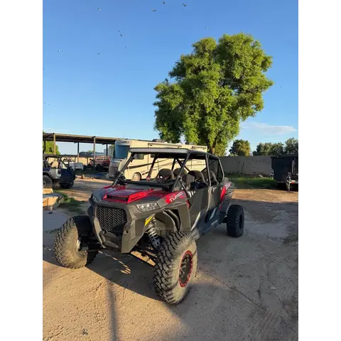
2013 Polaris Razor. Over $8k in aftermarket accessories. everything works as it should. located in Norwalk ca looking to get $9,000 t...

SXS / UTV16 hours ago
$35,000

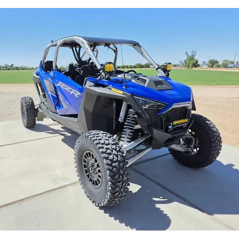
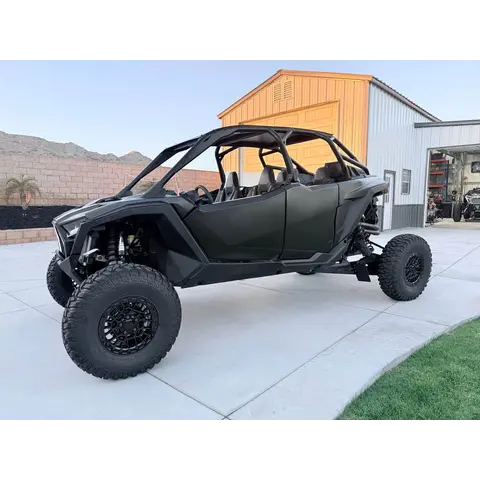
2022 Polaris rzr Pro R Premium

2022Yuma, AZ
StandardUsed
SaleSXS / UTV

Selling our 2022 Pro R Rzr in excellent condition. Garage kept, really low hours/miles (1,188 miles/103 hrs). Selling it with all accessorie...

SXS / UTV1 week ago
Show more
$17,500

2018 Polaris RZR xpt 4seater

2018Goodyear, AZ
StandardUsed
SaleSXS / UTV

2018 Polaris RZR xpt 4seater Fox Edition w/ Electric Power Steering Shock Therapy Stage 3 Suspension MTX Stereo with Subwoofer Car to ca...

SXS / UTV1 week ago
$40,500

2025 Polaris Pro R 4 Ultimate

2025Norco, CA
StandardUsed
SaleSXS / UTV

2025 Polaris RZR Pro R4 Ultimate. Black on black Fox Live valve Dynamix suspension Ride Command with stage 4 audio & sub Heated & Coole...

SXS / UTV1 week ago
List a vehicle that rides here