Dune weather summary: Aden Hills Off-Highway Vehicle Area, 93°, 7 mph. Alkali Lake OHV Area, 95°, 8 mph. Amargosa Big Dune, 95°, 9 mph. Aurora Open OHV Area, 84°, 23 mph, active alert: Flood Watch. Bangs Canyon OHV Trails, 88°, 8 mph. Barnwell Mountain Recreational Area, 95°, 6 mph, active alert: Heat Advisory. Blue Creek OHV Area, 91°, 11 mph. Boulders OHV Staging Area, 98°, 3 mph. Buttercup Valley, 101°, 9 mph, heat caution: HIGH HEAT - HYDRATE. Cameo Cliffs/Hook and OHV Ladder Trail System, 82°, 5 mph. Chappie/Shasta Off-Highway Vehicle Recreation Area, 70°, 0 mph. Cinder Hills OHV Area, 82°, --. Copper Basin Dunes OHV Area, 86°, 17 mph. Coral Pink Sand Dunes, 61°, 7 mph, active alert: Flood Watch. Crescent Sand Dunes, 75°, 21 mph. Cross Bar Ranch Off-Road Park, 102°, 10 mph, active alert: Heat Advisory. Crossroads OHV Area, 89°, 17 mph. Dove Springs OHV Area, 67°, 1 mph. Dumont Dunes, 81°, 0 mph. Dunes Off-Highway Vehicle Area, 84°, 6 mph. El Mirage OHV Area, 68°, 8 mph. Escondido Draw Recreational Area, 91°, 14 mph. Fort Sage Off-Highway Vehicle Area, 71°, 22 mph, active alert: Lake Wind Advisory. Fossil Creek OHV Trail, 70°, 7 mph. Gemini Bridges, 84°, 0 mph. Glamis / Imperial Sand Dunes, 96°, 12 mph. Glenwood Open OHV Area, 84°, 23 mph, active alert: Flood Watch. Gordon's Well, 101°, 9 mph, heat caution: HIGH HEAT - HYDRATE. Grand Valley Open OHV Area, 88°, 8 mph. Greater Sand Dunes SRMA, 79°, 6 mph. Hackberry Lake Off-Highway Vehicle Use Area, 95°, 8 mph. Hayfield Draw OHV Area, 93°, 3 mph. Haystack Mountain Off-Highway Vehicle Area, 81°, 11 mph. Head Canyon OHV Recreation Area, 84°, 6 mph. Hog Canyon OHV Trail System, 61°, 7 mph, active alert: Flood Watch. Hot Well Dunes Recreation Area, 91°, 4 mph. Hungry Valley SVRA, 58°, 11 mph. Jawbone Canyon OHV Area, 59°, 1 mph. Johnson Valley OHV Area, 69°, 4 mph. Killpecker Sand Dunes Open Play Area, 79°, 6 mph. Knolls Off-Highway Vehicle Special Recreation Management Area (SRMA), 86°, 15 mph. Little Sahara Recreation Area, 79°, 23 mph. Little Sahara State Park, 99°, 10 mph. McCullough Peaks OHV Area, 79°, 11 mph. Mescalero Sands North Dune Off-Highway Vehicle Area, 81°, 11 mph. Millican Valley OHV Trail System, 59°, 0 mph. Moon Rocks OHV Area, 69°, 11 mph, active alert: Lake Wind Advisory. Nellis Dunes OHV Area, 82°, 16 mph. North Sand Hills OHV Area, 73°, 7 mph. Northwest OHV Park, 98°, 7 mph, active alert: Heat Advisory. Oceano Dunes / Pismo Beach, 74°, 7 mph, active alert: Beach Hazards Statement. Ocotillo Wells SVRA, 87°, 4 mph. Pipestone OHV Area, 61°, 8 mph, active alert: Red Flag Warning. Poison Spider / Gold Bar, 87°, 6 mph. Rabbit Creek OHV Trail, 70°, 7 mph. Radar Hill OHV Area, 54°, 15 mph. Rasor Off-Highway Vehicle Area, 70°, 8 mph. Red Sands Off-Highway Vehicle Area, 90°, 5 mph. Rice Canyon Off-Highway Vehicle Area, 64°, 20 mph, active alert: Lake Wind Advisory. Robledo Mountains OHV Trail System, 93°, 7 mph. Rosita Flats OHV Area, 91°, 11 mph. Samoa Dunes, 63°, 2 mph. Sand Flats Recreation Area, 87°, 6 mph. Sand Mountain Open Off-Highway Vehicle Area, 79°, 17 mph. Sand Mountain Pipeline Designated Dispersed Camping Area, 79°, 17 mph. Sand Mountain Recreation Area, 73°, 5 mph, active alert: Red Flag Warning. Seep Springs OHV Area, 88°, 9 mph. Shoshone OHV Trail System, 72°, 5 mph. Shotgun Creek OHV Staging Area, 50°, 7 mph. Silver Lake ORV Area, 75°, 10 mph. South Cow Mountain OHV Management Area, 63°, 10 mph. St. Anthony Sand Dunes, 79°, 11 mph. St. Helen Motorsport Area, 75°, 9 mph. Standard Wash OHV Area, 86°, 17 mph. Stoddard Valley OHV Area, 68°, 6 mph. Table Mesa Recreation Area, 99°, 5 mph. Virtue Flat Off-Highway Vehicle Area, 63°, 0 mph. Weiser Dunes, 68°, 0 mph. Whitewash Sand Dunes Open OHV Area and Trail System, 84°, 0 mph. Winnemucca Sand Dunes, 72°, 6 mph.

Aden Hills Off-Highway… 93° 7 mph Alkali Lake OHV Area 95° 8 mph Amargosa Big Dune 95° 9 mph Aurora Open OHV Area 84° 23 mph Bangs Canyon OHV Trails 88° 8 mph Barnwell Mountain… 95° 6 mph Blue Creek OHV Area 91° 11 mph Boulders OHV Staging Area 98° 3 mph Buttercup Valley 101° 9 mph Cameo Cliffs/Hook and OHV… 82° 5 mph Chappie/Shasta Off-Highway… 70° 0 mph Cinder Hills OHV Area 82° -- Copper Basin Dunes OHV Area 86° 17 mph Coral Pink Sand Dunes 61° 7 mph Crescent Sand Dunes 75° 21 mph Cross Bar Ranch Off-Road Park 102° 10 mph Crossroads OHV Area 89° 17 mph Dove Springs OHV Area 67° 1 mph Dumont Dunes 81° 0 mph Dunes Off-Highway Vehicle Area 84° 6 mph El Mirage OHV Area 68° 8 mph Escondido Draw Recreational… 91° 14 mph Fort Sage Off-Highway… 71° 22 mph Fossil Creek OHV Trail 70° 7 mph Gemini Bridges 84° 0 mph Glamis / Imperial Sand Dunes 96° 12 mph Glenwood Open OHV Area 84° 23 mph Gordon's Well 101° 9 mph Grand Valley Open OHV Area 88° 8 mph Greater Sand Dunes SRMA 79° 6 mph Hackberry Lake Off-Highway… 95° 8 mph Hayfield Draw OHV Area 93° 3 mph Haystack Mountain… 81° 11 mph Head Canyon OHV Recreation… 84° 6 mph Hog Canyon OHV Trail System 61° 7 mph Hot Well Dunes Recreation Area 91° 4 mph Hungry Valley SVRA 58° 11 mph Jawbone Canyon OHV Area 59° 1 mph Johnson Valley OHV Area 69° 4 mph Killpecker Sand Dunes Open… 79° 6 mph Knolls Off-Highway Vehicle… 86° 15 mph Little Sahara Recreation Area 79° 23 mph Little Sahara State Park 99° 10 mph McCullough Peaks OHV Area 79° 11 mph Mescalero Sands North Dune… 81° 11 mph Millican Valley OHV Trail… 59° 0 mph Moon Rocks OHV Area 69° 11 mph Nellis Dunes OHV Area 82° 16 mph North Sand Hills OHV Area 73° 7 mph Northwest OHV Park 98° 7 mph Oceano Dunes / Pismo Beach 74° 7 mph Ocotillo Wells SVRA 87° 4 mph Pipestone OHV Area 61° 8 mph Poison Spider / Gold Bar 87° 6 mph Rabbit Creek OHV Trail 70° 7 mph Radar Hill OHV Area 54° 15 mph Rasor Off-Highway Vehicle Area 70° 8 mph Red Sands Off-Highway… 90° 5 mph Rice Canyon Off-Highway… 64° 20 mph Robledo Mountains OHV Trail… 93° 7 mph Rosita Flats OHV Area 91° 11 mph Samoa Dunes 63° 2 mph Sand Flats Recreation Area 87° 6 mph Sand Mountain Open… 79° 17 mph Sand Mountain Pipeline… 79° 17 mph Sand Mountain Recreation Area 73° 5 mph Seep Springs OHV Area 88° 9 mph Shoshone OHV Trail System 72° 5 mph Shotgun Creek OHV Staging Area 50° 7 mph Silver Lake ORV Area 75° 10 mph South Cow Mountain OHV… 63° 10 mph St. Anthony Sand Dunes 79° 11 mph St. Helen Motorsport Area 75° 9 mph Standard Wash OHV Area 86° 17 mph Stoddard Valley OHV Area 68° 6 mph Table Mesa Recreation Area 99° 5 mph Virtue Flat Off-Highway… 63° 0 mph Weiser Dunes 68° 0 mph Whitewash Sand Dunes Open… 84° 0 mph Winnemucca Sand Dunes 72° 6 mph

Labor Day

Happy Labor Day from Full Throttle Trader

Sand Sports Super Show 2026 logo Catch us at Booth 1006 · Sand Sports Super Show 2026 — OC Fair & Event Center — 88 Fair Dr, Costa Mesa, CA

Jawbone Canyon OHV Area

Wide variety of riding opportunities available

LocationJawbone Canyon and surrounding public lands
Entry points2 verified
Conditions59° · 1 mph

Trip check

Before you go

  • 🐢 THIS CLOSURE EXISTS BECAUSE OF THE DESERT TORTOISE. Riding a closed route in critical habitat is a federal violation, not a technicality, and it is the fastest way for riders to lose more ground. Stay inside the open area, stay on what is signed open, and never handle a tortoise — a frightened one voids its bladder and can die of dehydration.
  • Permit status not confirmed. Check with the managing agency.

Guide

About this area

The Jawbone Canyon Off-Highway Vehicle Area offers various riding opportunities including cross country play, trail riding, and advanced technical hill climbing.

Camping

The entire OHV area and surrounding public lands are open to primitive camping. Within Jawbone Canyon, there are a number of excellent primitive camping sites and OHV staging/off-loading areas.

Full agency description

Jawbone Canyon and Dove Springs OHV Areas are open for public use. Visitors are encouraged to practice Leave No Trace principles. The Jawbone Canyon Off-Highway Vehicle Area provides a wide variety of riding opportunities including cross country play, trail riding, and advanced technical hill climbing opportunities. Jawbone is also a great starting point to begin to explore the hundreds of miles of trail riding opportunities available in the area outside of the OHV Open Area. STAGING AND CAMPING AREAS: The entire OHV area and surrounding public lands are open to primitive camping. Within Jawbone Canyon, there are a number of excellent primitive camping sites and OHV staging/off-loading areas. Most of the sites within the OHV area are accessible by 2-wheel drive vehicles with trailers. TRAIL RIDING OUTSIDE THE OHV AREA: Outside of the OHV area and within the Jawbone-Butterbredt Area of Critical Environmental Concern (ACEC), motorized vehicle use is restricted to a specific designated road and trail network. All cross-country travel is prohibited in these areas, and the designated routes are marked with brown trail markers. You may only use the designated route network -- all other trails are closed -- even if you do not see a red closed sign. REGULATION INFORMATION: Either "Green or Red Sticker" OHV registration is mandatory for ALL vehicles that are not "street legal." Visitors from outside the state of California must have a valid permit/registration from an off-highway vehicle program in your home state. If you do not have a valid permit/registration from your home state, you will have to purchase a "Non-Resident OHV Permit" for California. This sticker can be purchased at the Jawbone OHV Station.
At a glance

Quick facts

Camping limit
14 Days
Managing agency
Bureau of Land Management

Access

Getting there

  • ⬆️ FROM THE SOUTH — left onto Jawbone Canyon RoadEntrance

    Jawbone Open Area is off State Highway 14, about 20 miles north of the SR-14 / SR-58 intersection at Mojave. Coming from the south it is a LEFT turn from SR-14 onto Jawbone Canyon Road.

    Pin from the managing agency
  • ⬇️ FROM THE NORTH — right onto Jawbone Canyon RoadEntrance

    Traveling from the north on SR-14 it is a RIGHT turn onto Jawbone Canyon Road.

    Pin from the managing agency

Rules

Rules

Specific to Jawbone Canyon OHV Area

  • 🔴 COURT-ORDERED ROUTE CLOSURES ACROSS THE WEST MOJAVE — IN FORCE SINCE 24 MARCH 2026, UNTIL FURTHER NOTICE. A federal court order requires the BLM to close ALL ROUTES in desert tortoise and Lane Mountain milk-vetch CRITICAL HABITAT to off-highway vehicle recreation throughout the West Mojave planning area — roughly 2,200 miles of route. ✅ THE OPEN RIDING AREA ITSELF IS STILL OPEN. What is closed are designated routes through critical habitat, including connectors and trails you may have ridden in previous years. Designated county roads and highways stay open for access, but NOT for public OHV recreational use. ⚠️ IF YOU ARE PLANNING TO RIDE ANYTHING OUTSIDE THE OPEN AREA BOUNDARY, check the current route map with the field office first — the maps in older guidebooks and apps are out of date.
Standard OHV rules (11)

Common equipment, registration and trail-use rules still apply.

  • ⭐ RIDE TO THE HIGHEST SAFETY STANDARD, NOT THE LEGAL MINIMUM. What is written below is what the managing agency requires. A helmet, eye protection, a flag and proper gear are what get you home — wear them whether or not the law where you are riding insists on it.
  • Either 'Green or Red Sticker' OHV registration is mandatory for ALL vehicles that are not 'street legal.' Visitors from outside the state of California must have a valid permit/registration from an off-highway vehicle program in your home state. If you do not have a valid permit/registration from your home state, you will have to purchase a 'Non-Resident OHV Permit' for California.
  • 🪖 Side-by-side / UTV (factory-built, steering wheel, bucket seats, under 1,000cc, does over 30 mph): helmets on the driver and every passenger, and seat belts or a harness fastened whenever it is moving. That is California law on public land.
  • 🪖 Sand car, sand rail, dune buggy, Jeep, or anything home-built or over 1,000cc: no helmet or seat-belt law applies. Wear them anyway — State Parks recommend it, and so do we.
  • 🪖 Quads and ATVs: helmet on every rider, any age. Dirt bikes: helmet required under 18.
  • ⚠️ Tuned it past 30 mph? A machine built for 30 or under that now goes faster is treated like a side-by-side — helmet and belt rules apply.
  • 👶 A child seat does not replace a helmet. In a side-by-side, a child in a car seat still wears one.
  • Source: California Vehicle Code §500, §38505, §38601–38602 — checked Aug 2026.
  • 🪖 Any helmet the law requires must meet FMVSS 218 and carry a DOT label — CVC 27802.
  • 📖 CHECK THE LAW YOURSELF — these requirements come from California State Parks OHMVR — Laws & Safety. Rules change, and you are responsible for compliance: ohv.parks.ca.gov
  • 🗺️ NO SIGNAL? TAKE AN OFFLINE MAP. BLM publish free GEOREFERENCED PDF maps that show your live GPS position with no cell service, in the Avenza Maps app or similar. Download the map for this area BEFORE you leave tarmac: www.blm.gov

Permits

Permits & registration

Permit and registration details

• REGULATION INFORMATION: Either "Green or Red Sticker" OHV registration is mandatory for ALL vehicles that are not "street legal." Visitors from outside the state of California must have a valid permit/registration from an off-highway vehicle program in your home state. • If you do not have a valid permit/registration from your home state, you will have to purchase a "Non-Resident OHV Permit" for California.

State residents
California residents: OHV must display a current Green Sticker or Red Sticker registration from the CA DMV.
Out-of-state riders
Out-of-state riders: a California Nonresident OHV Use Permit is required unless your OHV carries current registration from your home state. $30 ($31.95 online), valid from purchase through December 31 of that year.
Bureau of Land Management official page (current closures & alerts)

Permit and registration rules change. Confirm current requirements with the managing agency before you ride — you are responsible for compliance.

Trip support

Fuel, food & local help

Pump gas & diesel

  • 🔴 NOTHING AT THE AREA — fuel in townfuel

    BOTH APPROACHES · No fuel, no store and no drinking water at Jawbone. Arrive full with your cans filled.

  • ⬆️ FROM THE SOUTH — Mojave, CAfuel

    20 miles south at the SR-14 / SR-58 junction · The last real town on the southern approach.

  • ⬇️ FROM THE NORTH — Ridgecrest / Inyokern, CAfuel

    THE NORTHERN RESUPPLY · Ridgecrest is the biggest town on this side and where the BLM field office is.

Marketplace

Rigs and vehicles

Elsewhere

These listings are not nearby and their sellers have not said they ride here.

$25,000

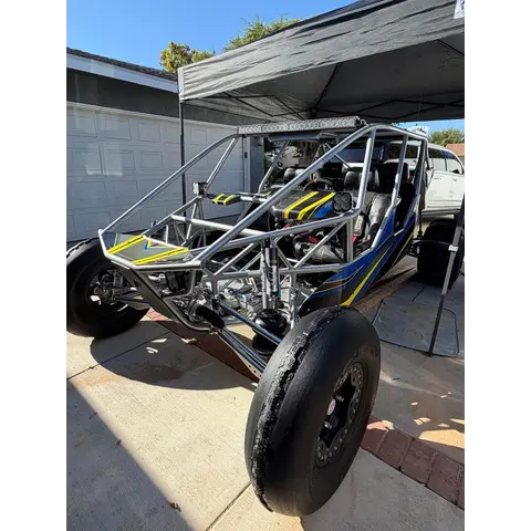
2014 MB 5 Seat Sand Rail

2014Orange, CA
StandardUsed
SaleDune Buggy

2014 MB 5-Seat Long Travel Sand Rail Clean, well-built 5-seat long travel sand rail with a great combination of performance, reliability,...

Dune Buggy6 days ago
$7,000

Polaris RZR 200 EFI

2025Orange, CA
StandardUsed
SaleSXS/UTV

FOR SALE: 2025 Polaris RZR 200 EFI – 50 Hours $7000.00 Excellent RZR 200 EFI with only 50 hours. Well set up, runs great, and has a ton o...

SXS/UTV6 days ago
$45,000

2 seat Potter Sandcar LS2/2d

2006Prescott, AZ
StandardUsed
SaleDune Buggy

This has been a great car! Got it in 2015-2016 Potter is still in business, had someone call them recently and ask about a 930 to 934 conve...

Dune Buggy2 weeks ago
Show more
$4,000

J&J aluminum sand car

1987Victorville, CA
StandardUsed
SaleDune Buggy

Aluminum A-arm J&J sand car with bench seat. Recently rewired, new Tach, console and gauges, rear disk brakes. Trans has close ratio gears...

Dune Buggy2 weeks ago
$16,000

2008 Sand Limo Squirt

2008Hooper, UT
StandardUsed
SaleSand Cars

2008 Sand Limo Squirt sand car NO TRADES! I can help with delivery to ID, CA and NV $16K -Powered by a 2.2 Ecotec motor from CBM w...

Sand Cars1 month ago
$57,000

2024 Can-Am Maverick R XRS

2024Mesa, AZ
StandardUsed
SaleSXS/UTV

2024 Can-Am Maverick R EVO E85 setup (pump, tubes, exhaust etc) TMW shorty cage TMW Bumper Triple R Lights (bumper, hood, pillar, light ...

SXS/UTV1 month ago
List a vehicle that rides here