Dune weather summary: Aden Hills Off-Highway Vehicle Area, 54°, 3 mph. Alkali Lake OHV Area, 64°, 8 mph. Amargosa Big Dune, 57°, 5 mph. Aurora Open OHV Area, 39°, 3 mph. Bangs Canyon OHV Trails, 45°, 3 mph. Barnwell Mountain Recreational Area, 57°, 0 mph. Blue Creek OHV Area, 61°, 14 mph. Boulders OHV Staging Area, 63°, 0 mph. Buttercup Valley, 70°, 9 mph. Cameo Cliffs/Hook and OHV Ladder Trail System, 54°, 6 mph. Chappie/Shasta Off-Highway Vehicle Recreation Area, 55°, 0 mph. Cinder Hills OHV Area, 42°, 20 mph. Copper Basin Dunes OHV Area, 64°, 6 mph. Coral Pink Sand Dunes, 54°, 5 mph. Crescent Sand Dunes, 37°, 5 mph. Cross Bar Ranch Off-Road Park, 58°, 0 mph. Crossroads OHV Area, 73°, 6 mph. Dove Springs OHV Area, 53°, 0 mph. Dumont Dunes, 64°, 2 mph. Dunes Off-Highway Vehicle Area, 37°, 5 mph. El Mirage OHV Area, 40°, 3 mph. Escondido Draw Recreational Area, 64°, 17 mph. Fort Sage Off-Highway Vehicle Area, 46°, 1 mph, active alert: Lake Wind Advisory. Fossil Creek OHV Trail, 45°, 3 mph. Gemini Bridges, 45°, 0 mph. Glamis / Imperial Sand Dunes, 64°, 8 mph. Glenwood Open OHV Area, 39°, 3 mph. Gordon's Well, 70°, 9 mph. Grand Valley Open OHV Area, 46°, 0 mph. Greater Sand Dunes SRMA, 36°, 6 mph, active alert: High Wind Watch. Hackberry Lake Off-Highway Vehicle Use Area, 64°, 8 mph. Hayfield Draw OHV Area, 63°, 0 mph. Haystack Mountain Off-Highway Vehicle Area, 53°, 7 mph, active alert: Flood Watch. Head Canyon OHV Recreation Area, 37°, 5 mph. Hog Canyon OHV Trail System, 55°, 9 mph. Hot Well Dunes Recreation Area, 72°, 5 mph. Hungry Valley SVRA, 44°, 4 mph. Jawbone Canyon OHV Area, 53°, 0 mph. Johnson Valley OHV Area, 59°, 7 mph. Killpecker Sand Dunes Open Play Area, 36°, 6 mph, active alert: High Wind Watch. Knolls Off-Highway Vehicle Special Recreation Management Area (SRMA), 43°, 3 mph. Little Sahara Recreation Area, 45°, 0 mph. Little Sahara State Park, 61°, 8 mph. McCullough Peaks OHV Area, 48°, 0 mph. Mescalero Sands North Dune Off-Highway Vehicle Area, 63°, 11 mph, active alert: Flood Watch. Millican Valley OHV Trail System, 45°, 6 mph. Moon Rocks OHV Area, 47°, 1 mph, active alert: Lake Wind Advisory. Nellis Dunes OHV Area, 59°, 5 mph. North Sand Hills OHV Area, 37°, 8 mph. Northwest OHV Park, 64°, 0 mph. Oceano Dunes / Pismo Beach, 55°, 0 mph, active alert: Coastal Flood Advisory. Ocotillo Wells SVRA, 72°, 12 mph. Pipestone OHV Area, 36°, 1 mph, active alert: Dense Fog Advisory. Poison Spider / Gold Bar, 45°, 0 mph. Rabbit Creek OHV Trail, 52°, 9 mph. Radar Hill OHV Area, 36°, 0 mph. Rasor Off-Highway Vehicle Area, 57°, 7 mph. Red Sands Off-Highway Vehicle Area, 63°, 5 mph. Rice Canyon Off-Highway Vehicle Area, 46°, 2 mph, active alert: Lake Wind Advisory. Robledo Mountains OHV Trail System, 63°, 5 mph. Rosita Flats OHV Area, 61°, 14 mph. Samoa Dunes, 55°, 9 mph, active alert: Coastal Flood Advisory. Sand Flats Recreation Area, 45°, 0 mph. Sand Mountain Open Off-Highway Vehicle Area, 39°, 0 mph. Sand Mountain Pipeline Designated Dispersed Camping Area, 54°, 5 mph. Sand Mountain Recreation Area, 50°, 4 mph, active alert: Lake Wind Advisory. Seep Springs OHV Area, 46°, 3 mph. Shoshone OHV Trail System, 39°, 0 mph. Shotgun Creek OHV Staging Area, 39°, 0 mph. Silver Lake ORV Area, 55°, 3 mph. South Cow Mountain OHV Management Area, 46°, 0 mph, active alert: Frost Advisory. St. Anthony Sand Dunes, 36°, 3 mph. St. Helen Motorsport Area, 48°, 6 mph. Standard Wash OHV Area, 64°, 6 mph. Stoddard Valley OHV Area, 53°, 5 mph. Table Mesa Recreation Area, 63°, 0 mph. Virtue Flat Off-Highway Vehicle Area, 45°, 6 mph. Weiser Dunes, 45°, 3 mph. Whitewash Sand Dunes Open OHV Area and Trail System, 45°, 0 mph. Winnemucca Sand Dunes, 37°, 7 mph.

ⓘ
Aden Hills Off-Highway… 54° 3 mph Alkali Lake OHV Area 64° 8 mph Amargosa Big Dune 57° 5 mph Aurora Open OHV Area 39° 3 mph Bangs Canyon OHV Trails 45° 3 mph Barnwell Mountain… 57° 0 mph Blue Creek OHV Area 61° 14 mph Boulders OHV Staging Area 63° 0 mph Buttercup Valley 70° 9 mph Cameo Cliffs/Hook and OHV… 54° 6 mph Chappie/Shasta Off-Highway… 55° 0 mph Cinder Hills OHV Area 42° 20 mph Copper Basin Dunes OHV Area 64° 6 mph Coral Pink Sand Dunes 54° 5 mph Crescent Sand Dunes 37° 5 mph Cross Bar Ranch Off-Road Park 58° 0 mph Crossroads OHV Area 73° 6 mph Dove Springs OHV Area 53° 0 mph Dumont Dunes 64° 2 mph Dunes Off-Highway Vehicle Area 37° 5 mph El Mirage OHV Area 40° 3 mph Escondido Draw Recreational… 64° 17 mph Fort Sage Off-Highway… 46° 1 mph Fossil Creek OHV Trail 45° 3 mph Gemini Bridges 45° 0 mph Glamis / Imperial Sand Dunes 64° 8 mph Glenwood Open OHV Area 39° 3 mph Gordon's Well 70° 9 mph Grand Valley Open OHV Area 46° 0 mph Greater Sand Dunes SRMA 36° 6 mph Hackberry Lake Off-Highway… 64° 8 mph Hayfield Draw OHV Area 63° 0 mph Haystack Mountain… 53° 7 mph Head Canyon OHV Recreation… 37° 5 mph Hog Canyon OHV Trail System 55° 9 mph Hot Well Dunes Recreation Area 72° 5 mph Hungry Valley SVRA 44° 4 mph Jawbone Canyon OHV Area 53° 0 mph Johnson Valley OHV Area 59° 7 mph Killpecker Sand Dunes Open… 36° 6 mph Knolls Off-Highway Vehicle… 43° 3 mph Little Sahara Recreation Area 45° 0 mph Little Sahara State Park 61° 8 mph McCullough Peaks OHV Area 48° 0 mph Mescalero Sands North Dune… 63° 11 mph Millican Valley OHV Trail… 45° 6 mph Moon Rocks OHV Area 47° 1 mph Nellis Dunes OHV Area 59° 5 mph North Sand Hills OHV Area 37° 8 mph Northwest OHV Park 64° 0 mph Oceano Dunes / Pismo Beach 55° 0 mph Ocotillo Wells SVRA 72° 12 mph Pipestone OHV Area 36° 1 mph Poison Spider / Gold Bar 45° 0 mph Rabbit Creek OHV Trail 52° 9 mph Radar Hill OHV Area 36° 0 mph Rasor Off-Highway Vehicle Area 57° 7 mph Red Sands Off-Highway… 63° 5 mph Rice Canyon Off-Highway… 46° 2 mph Robledo Mountains OHV Trail… 63° 5 mph Rosita Flats OHV Area 61° 14 mph Samoa Dunes 55° 9 mph Sand Flats Recreation Area 45° 0 mph Sand Mountain Open… 39° 0 mph Sand Mountain Pipeline… 54° 5 mph Sand Mountain Recreation Area 50° 4 mph Seep Springs OHV Area 46° 3 mph Shoshone OHV Trail System 39° 0 mph Shotgun Creek OHV Staging Area 39° 0 mph Silver Lake ORV Area 55° 3 mph South Cow Mountain OHV… 46° 0 mph St. Anthony Sand Dunes 36° 3 mph St. Helen Motorsport Area 48° 6 mph Standard Wash OHV Area 64° 6 mph Stoddard Valley OHV Area 53° 5 mph Table Mesa Recreation Area 63° 0 mph Virtue Flat Off-Highway… 45° 6 mph Weiser Dunes 45° 3 mph Whitewash Sand Dunes Open… 45° 0 mph Winnemucca Sand Dunes 37° 7 mph

Halloween

Happy Halloween from Full Throttle Trader

Blue Creek OHV Area

Panhandle Sand

LocationNear Sanford and Stinnett, Texas Panhandle — northwest side of Lake Meredith off FM 1913
Entry points1 verified
Size275 acres · about 10 miles of riding
Conditions61° · 14 mph

Trip check

Before you go

  • Two permits are required and one of them is not sold here. You need a free NPS ORV permit and a Texas State ORV decal from TPWD Customer Service on (512) 389-8917.
  • Permit required — The NPS ORV permit is free. Apply by email to [email protected] or in person at Park Headquarters. Annual permits run 1 January to 31 December and must be renewed each year. You also need a Texas State OHV decal, bought separately through Texas Parks & Wildlife on (512) 389-8917.
  • 🔴 ATV operators need a Texas safety certificate under Section 663.031 of the Texas Transportation Code. This catches out-of-state riders who have never needed one.

Guide

About this area

• 275 acres, about 10 miles of riding, on the northwest side of Lake Meredith • Hard-packed trail and creek bed, with sandy, muddy and rocky sections • Elevation 2,900–3,000 ft — which is why the rule is 'stay below 3,000 ft' • Mostly intermediate; some beginner ground, very little expert. Few steep hills, small jumps…

Camping

• Primitive dispersed camping on site
• Picnic tables, BBQ grills and vault-evaporator toilets
• 🔴 No drinking water and no hookups — bring everything
• ⚠️ Not bookable: Blue Creek offers no reservations through Recreation.gov, it is first-come
• Shared with equestrian campers

Facilities

• Vault-evaporator toilets
• Picnic tables and BBQ grills
• Primitive camping on site — dispersed, and shared with equestrian users
• 🔴 NO drinking water · no flush toilets · no hookups
• Gasoline is 5–20 miles away; water and RV services 20–30 miles

Full agency description

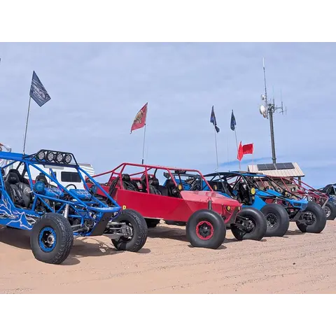
Blue Creek is 275 acres of hard-packed trail and creek bed on the northwest side of Lake Meredith, about 10 miles of riding at 2,900 to 3,000 feet in the Texas Panhandle. It is one of the few places in Texas that officially takes dune buggies and sand rails alongside bikes, quads and unregistered 4x4s, and it is free to ride — but you need two permits, and riding is confined to the creek bed itself. It is also shared with horseback riders, so it is not a place to come around a blind bend at speed.

At a glance

Quick facts

Best season
Open daily, year-round
Camping limit
No drinking water. Vault-evaporator toilets only.
Managing agency
National Park Service — Lake Meredith National Recreation Area
Permit status
Permit required

Access

Getting there

  • FM 1913 — the way inEntrance

    Blue Creek sits on the northwest side of Lake Meredith off FM 1913. From Amarillo: Loop 335 North, then Hwy 136 North to Fritch. From the north: FM 1913 from the Dumas Highway or FM 1913 from US-287. Come in off 1913 — do NOT navigate to the middle of the area.

    Pin from the managing agency

Rules

Rules

Specific to Blue Creek OHV Area

  • Shared use with horseback riders so yield and slow down.
  • 🔴 Blue Creek off-road use is in the creek bed only. Riding outside the creek bed is not permitted.
  • Stay within the cutbanks of Blue Creek and Rosita and below 3,000 ft elevation.
  • 🔴 You need two permits and one is not sold at the park.
Show all 18 area-specific rules
  • 🔴 ATV operators also need a valid Texas safety certificate.
  • Where you can ride in the area.
  • One decal is required per VIN and you need the year, make, model and VIN to apply.
  • Texas OHV decal is required on public land, costs $16 and is valid for one year. It applies to non-street-legal motorcycles, ATVs and 4x4s on any public land in Texas. Street-legal vehicles and private land are exempt.
  • Riding public land in Texas without the decal risks a citation and a fine of $25 to $500.
  • 🪖 Texas requires riders under 18 to wear a DOT-standard helmet and eye protection. Adults are not required to but should.
  • Texas riders under 14 may only ride with a parent or authorized adult. Ages 14 to 17 may ride alone but must have completed a state-approved ATV safety course.
  • 🎫 You need both an NPS ORV Permit for Lake Meredith and a Texas State OHV decal. Riders get caught out having only one.
  • 🎫 The NPS permit is free but you must apply. Submit the application to [email protected] or in person as you cannot buy it at a gate.
  • The annual permit runs 1 January to 31 December and it is not twelve months from the day you buy it. Buy one in November and it dies on 31 December.
  • 🎫 Texas State OHV decal is from Texas Parks & Wildlife Customer Service at (512) 389-8917.
  • 🪖 Helmets and eye protection are required for every rider with no age exemption. This is stricter than Texas state law so everyone wears one.
  • All ATVs must have a whip and flag.
  • Source: Texas Parks & Wildlife Texas OHV Program Transportation Code 663.031 — tpwd.texas.gov
Standard OHV rules (3)

Common equipment, registration and trail-use rules still apply.

  • Ride to the highest safety standard, not the legal minimum. A helmet, eye protection, a flag and proper gear are what get you home.
  • Spark arrestor is required on all vehicles.
  • Safety flag must be solid red or orange, minimum 6 x 12 inches, no more than 10 inches from the top of the whip. It can be a pennant, triangle, square or rectangle.

Permits

Permits & registration

Permit required

Day pass
NPS ORV Permit is free but you must apply in advance.
Permit and registration details

The NPS ORV permit is free. Apply by email to [email protected] or in person at Park Headquarters. Annual permits run 1 January to 31 December and must be renewed each year. You also need a Texas State OHV decal, bought separately through Texas Parks & Wildlife on (512) 389-8917.

State residents
Texas residents need a Texas State ORV decal to ride the Lake Meredith OHV areas.
Out-of-state riders
Out-of-state riders need the Texas State ORV decal regardless of where you live, and ATV operators additionally need a Texas-issued safety certificate. Buy the decal from TPWD Customer Service at (512) 389-8917 before you travel.

Where to buy

  • NPS ORV Permit — apply to [email protected] or in person
  • Texas State OHV decal — Texas Parks & Wildlife, (512) 389-8917
National Park Service — Lake Meredith National Recreation Area official page (current closures & alerts)

Permit rules change. Confirm with the managing agency before you ride.

Trip support

Fuel, food & local help

Local fuel notes (3)
  • Gasoline is 5–20 miles out; water and RV services 20–30 miles.
  • Sanford and Stinnett are the nearest towns, and Amarillo is about 52 miles by road.
  • Fill before you turn onto FM 1913.

Pump gas & diesel

  • NOTHING ON FM 1913 — fuel before you turn offfuel

    Top off before the last stretch · FM 1913 runs a long way with nothing on it, and there is no water or fuel at Blue Creek. Fill up before you commit to the last 18 miles.

  • Fritch / Sanford — closest to the lakefuel

    Closest town to Lake Meredith · Nearest fuel to the recreation area. Park HQ is at 419 E. Broadway in Fritch if you need the office.

  • Loves Travel Stop — 720 N Dumas Ave, Dumasfuel

    COMING FROM THE NORTH on the Dumas Highway · 🚚 Travel stop, open 24 hours — room for a rig and trailer.

Show all 4 pump gas & diesel listings
  • Services can be found in Amarillofuel

    COMING FROM THE SOUTH via Loop 335 · Everything you need, and the last big town if you are heading up from I-40.

Marketplace

Rigs and vehicles

For sale nearby

$270,000

FUNCO

2026Queen Creek, AZ588 miles away
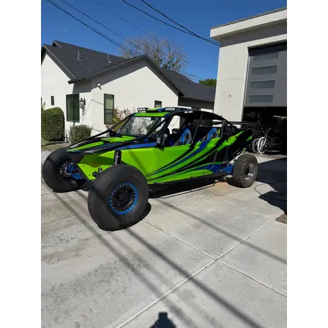
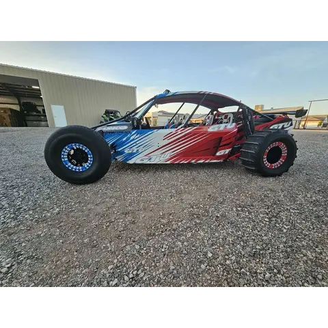
StandardUsed
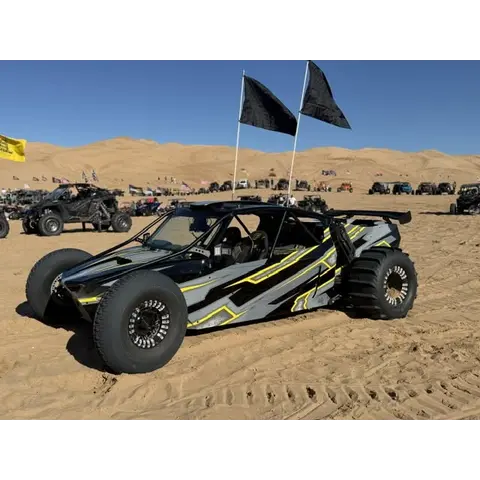
SaleDune Buggy / Sand Car

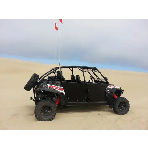
2026 Funco GTU Two Seater Redline Performance 436cui RHS with 3.8 whipple on E85 made 1015 hp to the hub @16psi Albins Transmission with t...

Show more
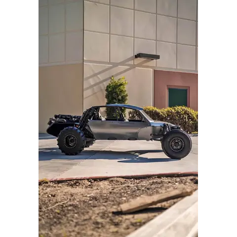
$1

PRICE DESIGNS

PRICE DESIGNS · SXS/SAND CAR/TRUCKGilbert, AZ597 miles away
StandardNew
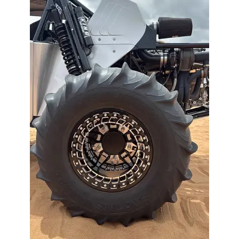
SaleParts — Wheels & Tires

We lead the industry in style, customizability, and innovation. Our wheels are designed, manufactured, and finished in-house, utilizing qual...

$17,500

2018 Polaris RZR xpt 4seater

2018Goodyear, AZ632 miles away
StandardUsed
SaleSXS / UTV

2018 Polaris RZR xpt 4seater Fox Edition w/ Electric Power Steering Shock Therapy Stage 3 Suspension MTX Stereo with Subwoofer Car to ca...

SXS / UTV1 week ago
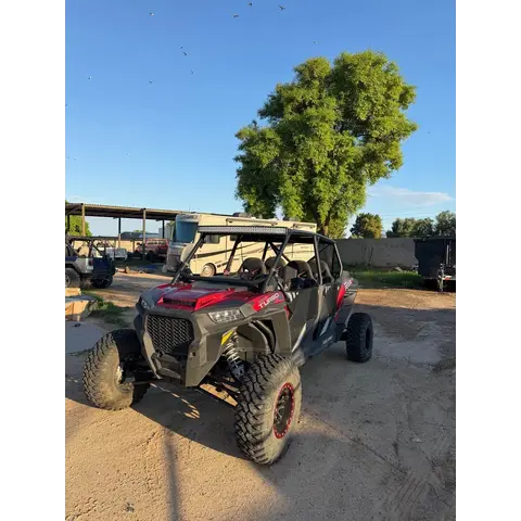
$16,000

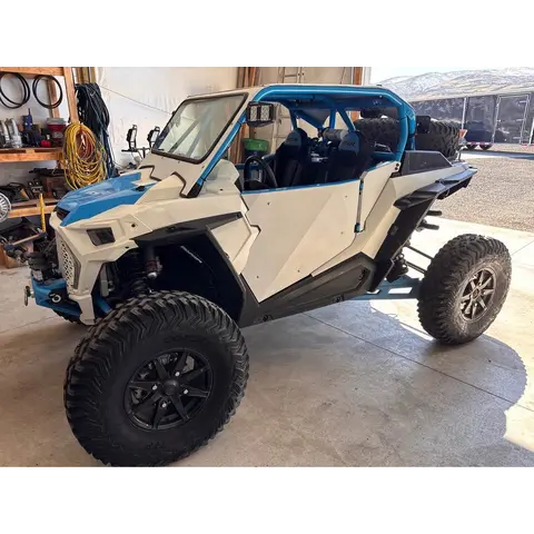
2020 Polaris Rzr TurboS

2020Riverton, UT649 miles away
StandardUsed
SaleSXS / UTV

Upgraded 2020 Polaris Rzr TurboS has 3,773 miles. This white and blue side-by-side vehicle has an RSK cage and RSK doors. The transmission h...

SXS / UTV1 week ago
$22,000

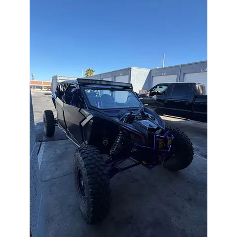
2018 Can Am Maverick X

2018Boulder City, NV739 miles away
StandardUsed
SaleSXS / UTV

2018 Can Am Maverick X Lonestar race kit, fully prepped, ready to rip. Shock therapy steering, full car to car, all headsets included and h...

SXS / UTV1 week ago
$21,000

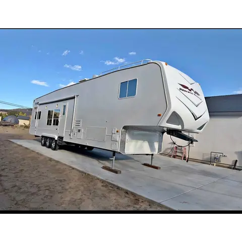
2008 Weekend Warrior cl4005

2008Henderson, NV745 miles away
StandardUsed
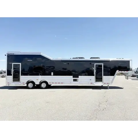
SaleToy Hauler

2008 Weekend Warrior cl4005 Fully Renovated Toy Hauler. New tires, new vinyl flooring, updated LED lighting, new bulldog landing gear, fresh...

Toy Hauler1 week ago

Elsewhere

These listings are not nearby and their sellers have not said they ride here.

$9,000

2013 Polaris Razor

2013Norwalk, CA
StandardUsed
SaleSXS / UTV

2013 Polaris Razor. Over $8k in aftermarket accessories. everything works as it should. located in Norwalk ca looking to get $9,000 t...

SXS / UTV16 hours ago
$35,000

2022 Polaris rzr Pro R Premium

2022Yuma, AZ
StandardUsed
SaleSXS / UTV

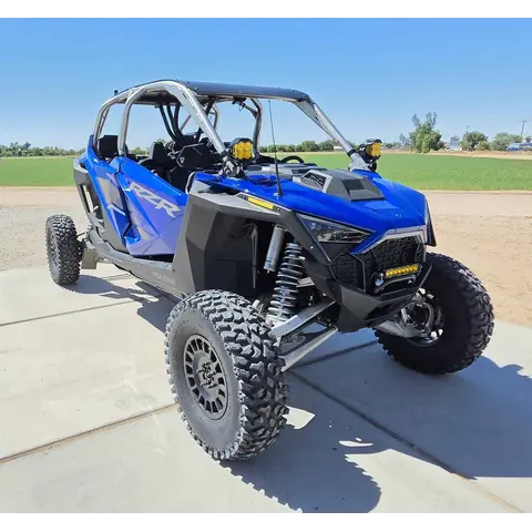
Selling our 2022 Pro R Rzr in excellent condition. Garage kept, really low hours/miles (1,188 miles/103 hrs). Selling it with all accessorie...

SXS / UTV1 week ago
Show more
$40,500

2025 Polaris Pro R 4 Ultimate

2025Norco, CA
StandardUsed
SaleSXS / UTV

2025 Polaris RZR Pro R4 Ultimate. Black on black Fox Live valve Dynamix suspension Ride Command with stage 4 audio & sub Heated & Coole...

SXS / UTV1 week ago
List a vehicle that rides here

Agency & verification

Managing agency

National Park Service — Lake Meredith National Recreation Area

Information last checked: Aug 14, 2026

Area information is informational only and may be inaccurate or out of date. Verify access, weather, closures, permits and hazards before and during any trip. See Terms.