⚠️ Fire ban was in effect in and around Moab as of 14 August 2026; no fires and no personal fireworks of any kind. Fire restrictions change through the season; confirm with the Moab Field Office on 435-259-2100 before you go.
Permit status not confirmed. Check with the managing agency.
Red rock canyon country means exposure, drop-offs and no shade in summer. BLM describes one connector route as an extreme challenge for the hardy few.
Guide
About this area
• 13.5 miles, rated MODERATE, northwest of Moab • 🔴 POINT-TO-POINT — A SHUTTLE IS REQUIRED. It starts on Highway 313 and comes out on Highway 191, it is not a loop • Nearly all downhill except the climb out of Little Canyon • Surface is a mix of graded road, slickrock, sand and steep descents • Named for Gemini…
Facilities
• Maps and signs at every junction — but BLM still says bring your own map
• BLM lists no toilets, no water and no services at the trailhead
• Moab is the nearest town for everything
Full agency description
Gemini Bridges Road is a 13.5-mile point-to-point run northwest of Moab, rated moderate, and one of the great scenic days in the area — the twin natural spans it is named for, Gooney Bird Rock, views over Behind the Rocks and down into Arches. It starts high on Highway 313 and drops almost the whole way to Highway 191, so it is mostly downhill apart from the climb out of Little Canyon, and it is point-to-point rather than a loop, so you need a shuttle. 🔴 Before you plan a trip here, check the current Motor Vehicle Use Map: the Labyrinth Rims / Gemini Bridges travel plan closed 317 miles of motorized route in this area and BLM reopened the question in September 2025.
At a glance
Quick facts
Best season
Spring and fall
Managing agency
BLM Moab Field Office
Access
Getting there
Gemini Bridges TrailheadTrailhead
West on Utah Highway 313 from its terminus at US-191, 13 miles. The trailhead is along Highway 313.
🔴 Check the current Motor Vehicle Use Map before you go; the Labyrinth Rims / Gemini Bridges Travel Management Plan closed 317 miles of motorized route (28% of the 1,128 miles inventoried).
Roughly 700 miles stayed open, 100 miles limited, and 300 miles closed; BLM opened a reassessment in September 2025.
Gemini Bridges Road is a designated motorized route, published by BLM as a vehicle destination and listed as an active 4x4 trail.
Grand County and Utah rules differ by route; confirm street-legal requirements with the Moab Field Office on 435-259-2100 before unloading a non-plated machine.
Show all 6 area-specific rules
Point-to-point route; arrange a shuttle before you start.
Carry your own map even though junctions are signed.
Standard OHV rules (8)
Common equipment, registration and trail-use rules still apply.
Ride to the highest safety standard, not the legal minimum; a helmet, eye protection, a flag and proper gear are what get you home.
Stay on designated routes; much of the surrounding network is mountain bike singletrack.
🪖 Utah requires a DOT safety-rated helmet for anyone under 18 on public land on an ATV, motorcycle or snowmobile; everyone else is strongly advised to wear one.
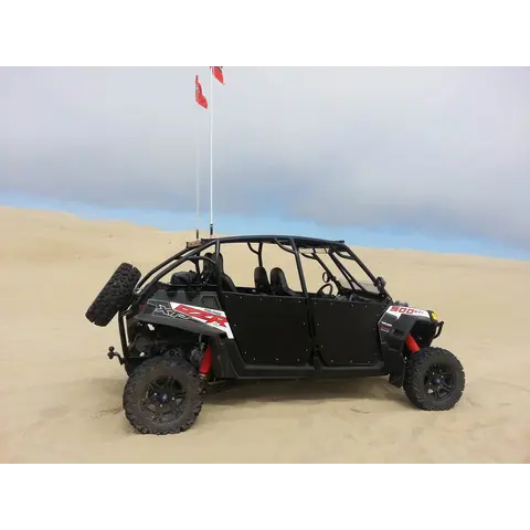
Utah requires a red or orange whip flag, minimum 6 x 12 inches, when riding a sand dune area.
Under 18 you must be able to reach and work every control, hold a valid Utah OHV education certificate, and be under direct adult supervision.
Utah non-resident OHV permit required to ride public land: $30, valid 12 months; home-state registration does not replace it. Utah OHV registration is required for residents.
🗺️ Take an offline map; BLM publish free georeferenced pdf maps that show your live GPS position with no cell service. Download the map before you leave tarmac: www.blm.gov
Permits
Permits & registration
Permit and registration details
BLM lists no fee for the Gemini Bridges Trailhead; Utah OHV rules still apply, see the state requirements below.
State residents
Utah residents: OHV registration required.
Out-of-state riders
Out-of-state riders: a Utah non-resident OHV permit is required to ride on public land. $35, valid 12 months from purchase, and it must be bought online; the permanent permit takes up to 20 business days.
Permit and registration rules change; confirm current requirements with the managing agency before you ride.
Trip support
Fuel, food & local help
Local fuel notes (14)
FROM THE NORTH (Salt Lake, Denver): I-70 to CRESCENT JUNCTION, then about 30 miles south on US-191. Green River is the last full-service town on I-70 before the junction.
FROM THE SOUTH (Arizona, southern Utah): US-191 north through Monticello and Blanding, then Spanish Valley into Moab.
��️ Crescent Junction is a highway junction, not a town — do not assume services there.
Coming off I-70 late, the Chevron at 13707 N Hwy 191 closes at 8PM, so Green River is the safer top-off.
Moab has fuel everywhere — 16 stations on the US-191 corridor at last count, so do not plan your day around it.
Four things are worth knowing: 🚚 TOWING — the Sinclair at 1261 S Main is the one riders name as having trailer-accessible pumps.
Love's Travel Stop at 1810 W Main is a full travel center with diesel and pull-through lanes.
💰 PRICE SPREAD IS REAL —toin August 2026.
The Sinclair at 585 E Main and the Conoco on 2490E were; both Maveriks were.
On a truck and a trailer that gap is worth the detour.
��️ HOURS — most of the corridor runs 24 hours, but the Chevron at 13707 N Hwy 191 closes at 8PM, White Mesa Travel Center at 7PM, Shady Acres at 11PM and the Conoco at 433 N Main at 9:30PM.
Coming down from I-70 late, do not count on the north end.
There is no fuel at any trailhead — Sand Flats, Poison Spider and Gemini Bridges all have nothing past the turn-off.
Fill in town.
Pump gas & diesel
🚚 Sinclair — 1261 S Main StfuelGasoline
US-191 corridor, south of Moab · 1261 S Main St · (435) 678-3344 · open 24 hours · 🚚 Riders call this "the only pump in town that has accessable pumps for trailers." If you are towing, this is the one.More
US-191 corridor, south of Moab · 1261 S Main St · (435) 678-3344 · open 24 hours · 🚚 Riders call this "the only pump in town that has accessable pumps for trailers." If you are towing, this is the one.
🚚 Love's Travel Stop — 1810 W Main StfuelfoodGasolineDiesel
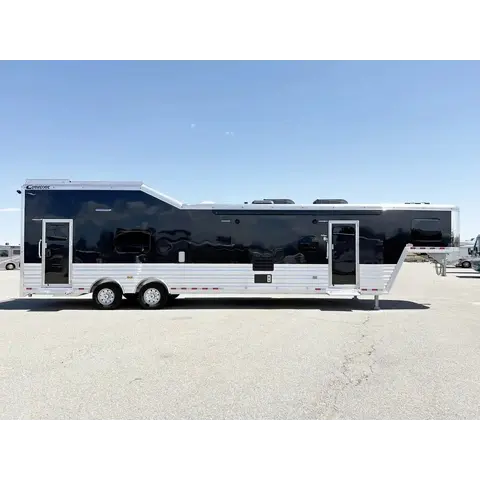
US-191 corridor · 1810 W Main St · (435) 564-8262 · open 24 hours · Full travel center — diesel, pull-through lanes, height for a toy hauler. Travel center — hot food as well as fuel, and room to park a rig.More
US-191 corridor · 1810 W Main St · (435) 564-8262 · open 24 hours · Full travel center — diesel, pull-through lanes, height for a toy hauler. Travel center — hot food as well as fuel, and room to park a rig.
US-191 north of Moab · 13707 N Highway 191 · (855) 285-9595 · ⚠️ CLOSES 8PM. Coming south from I-70 this is the last one before town, and it shuts early.More
US-191 north of Moab · 13707 N Highway 191 · (855) 285-9595 · ⚠️ CLOSES 8PM. Coming south from I-70 this is the last one before town, and it shuts early.
COMING FROM THE WEST on I-70 — fill up here, before Crescent Junction · There is nothing at Crescent Junction where you turn south onto US-191, and nothing between there and Moab.More
COMING FROM THE WEST on I-70 — fill up here, before Crescent Junction · There is nothing at Crescent Junction where you turn south onto US-191, and nothing between there and Moab.
Fruita / Grand Junction, CO — last fuel EASTBOUND on I-70fuel
COMING FROM THE EAST on I-70 — fill up here, before Crescent Junction · Sams Club, Walmart Fuel and Maverik are all right off I-70. Nothing again until Moab.More
COMING FROM THE EAST on I-70 — fill up here, before Crescent Junction · Sams Club, Walmart Fuel and Maverik are all right off I-70. Nothing again until Moab.
Area information is informational only and may be inaccurate or out of date. Verify access, weather, closures, permits and hazards before and during any trip. See Terms.
Your privacy
We use essential cookies to run the site and, with your consent, analytics cookies to improve it. See our Privacy Policy.